Skip to main content
Healthy Oceans. Healthy Communities.
Donate
Blog
Newsletters
A
B
C
English
Français
About Us
About Us
Board of Directors
The Team
Collaborations
Our Supporters
Employment
Annual Reports
Contact Us
Initiatives
Initiatives
Ocean Planning
Energy and Climate Change
Salmon Farming
Ocean Ecosystems
Sustainable Seafood
Ocean Acidification
Clear the Coast
Media Center
Media Center
Media Releases
News
LOS in the News
Blog
Newsletters
Reports & Publications
Maps
Take Action
Take Action
DFO's Transition Plan
Send a Message
Stay Informed
Donate
DFO'S Transition Plan
Ocean Exposures Photo Contest 2025
Search form
Search
You are here
Home
Maps
Maps
Maps
Initiatives
- Any -
Clear the Coast
Energy and Climate Change
Ocean Acidification
Ocean Ecosystems
Ocean Planning
Salmon Farming
Sustainable Seafood
Map Style
- Any -
Static
Interactive
Keywords
Salmon Farm Closures as at October, 2025
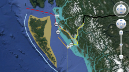
BC and Washington Salmon Farms Interactive Map
Salmon Farm Closures as at February, 2023
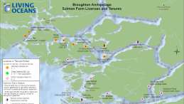
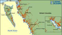
Salmon Farm Licenses and Tenures Broughton Archipelago
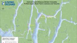
Salmon Farm Licenses and Tenures Central Coast (Kitasoo)
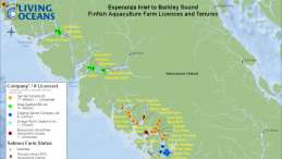
Salmon Farm Licenses and Tenures Esperanza Inlet to Barkley Sound
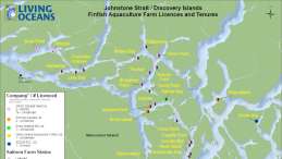
Salmon Farm Licenses and Tenures Johnstone Strait/Discovery Islands
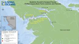
Salmon Farm Licenses and Tenures Quatsino Sound to Kyuquot Sound
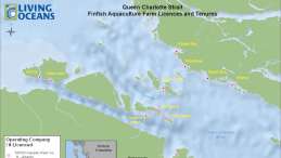
Salmon Farm Licenses and Tenures Queen Charlotte Strait
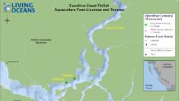
Salmon Farm Licenses and Tenures Sunshine Coast
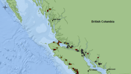
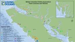
Salmon Farm Licenses and Tenures British Columbia
Broughton Archipelago Transition Initiative
Discovery Islands Salmon Farm Closure December, 2020
Oil and Water - Navigate the Facts
Canadian Sewage Regulations
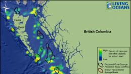
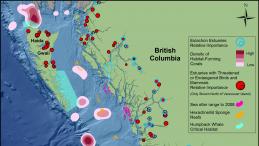
Corals and Sponges - 12 Areas Worth Protecting
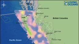
Marine Protected Areas and Areas of High Conservation Value
Oil Spill Model
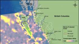
BC Marine Protected Areas and Areas of High Conservation Utility
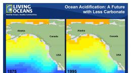
Ocean Acidification: A Future with Less Carbonate
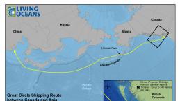
Great Circle Shipping Route between Canada and Asia
Zone proposée d'interdiction des pétroliers
Areas of High Conservation Utility
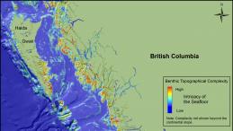
BC Benthic Topographical Complexity
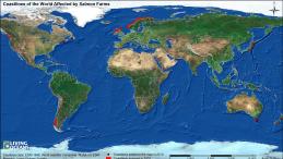
Coastlines of the World Affected by Salmon Farms
Disabled Tanker Drift Rate vs. Voluntary Tanker Exclusion Zone
Economically Valuable Areas for Bottom Trawl vs. Coral-Sponge Protection Areas
Eelgrass
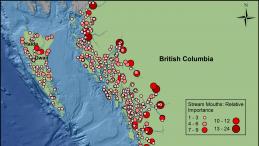
Important Coastal Streams
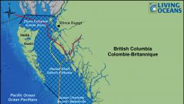
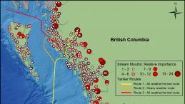
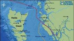
Important Coastal Streams and Proposed Tanker Routes
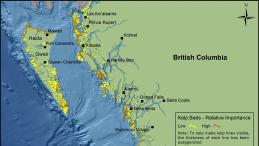
Kelp Beds
Kinder Morgan Pipeline and Associated Tanker Route
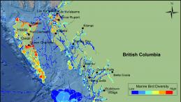
Marine Bird Habitat
Marine Protected Areas in BC
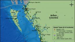
Marine Vessel Incidents in Canada's Pacific Waters January 1999 - April 2013
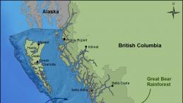
Pacific North Coast Integrated Management Areas and the Great Bear Rainforest
Pilotage Areas along the BC Coast
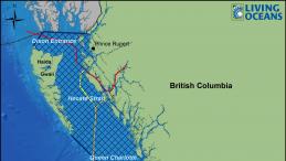
Proposed Oil Tanker Prohibition Area
Proposed Tanker Routes through the Inside Passage to Kitimat
Rare, Threatened and Endangered Species in British Columbia
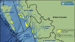
Rockfish Conservation Areas by BC Regions
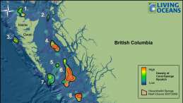
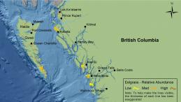
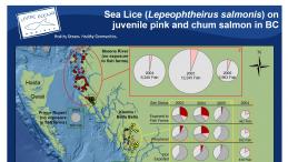
Sea Lice (Lepeophtheirus salmonis) on juvenille pink and chum salmon in BC
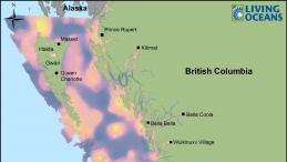
Selected Ecosystem Features of the North Coast of BC
Traffic Routes and Port Locations for Major Vessels in BC Waters
Wild Salmon Narrows - Proposed Farm-free Migration Route